
Mapping exante risks of COVID‐19 in Indonesia using a Bayesian geostatistical model on airport network data
- by admin
- in Publications
- posted 19 12 月, 2022
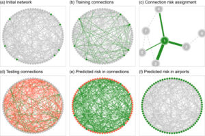
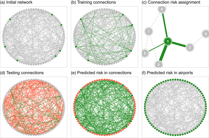
A rapid response to global infectious disease outbreaks is crucial to protect public health. Ex
ante information on the spatial probability distribution of early infections can guide
governments to better target protection efforts. We propose a two‐stage statistical approach
to spatially map the exante importation risk of COVID‐19 and its uncertainty across
Indonesia based on a minimal set of routinely available input data related to the Indonesian
flight network, traffic and population data, and geographical information.